With over 300 days of sunshine and an average temperature of 68 degrees, it’s no wonder Austin is often ranked one of the fittest cities in the nation. From cycling through the hill country to stand-up paddle boarding on Town Lake, Austin offers residents and visitors a copious amount of outdoor activities. For most, being active in Austin, TX just comes naturally.
Austin’s Best Outdoor Areas
Lady Bird Lake Hike and Bike
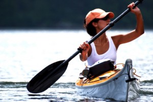
Perhaps the largest and most-loved outdoor area in Austin is Lady Bird Lake Hike and Bike Trail. Formerly known as Town Lake, Lady Bird Lake is actually a reservoir on the Colorado River that is approximately six miles long and flows through the heart of downtown Austin. Its average depth is around 14 feet and its width spans from 400 feet to 2,500 feet. Lady Bird Lake Hike and Bike Trail is an extremely popular place for jogging and bike riding. Several bridges cross the lake allowing you to turn around at different distance points. Because the lake is calm, it is the perfect spot for kayaking, rowing and canoeing. If you do not have your own bike or kayak, don’t worry. There are plenty of places along the lake to rent one for a couple of hours or the entire day. With its amazing views of downtown, countless outdoor activities and miles of trails, it is no surprise the Lady Bird Lake Hike and Bike is one of the best outdoor areas in Austin, TX.
Barton Creek Greenbelt
Considered the seventh best hiking trail in Texas, the Barton Creek Greenbelt is an urban oasis. Its limestone cliff walls, lush vegetation and popular swimming areas make the Greenbelt an ideal location for biking, running, rock climbing, swimming and hiking. Commonly referred to as the “crown jewel of Austin” by adventure-seeking locals and visitors, the Barton Creek Greenbelt is roughly 7.9 miles long and extends across 809 acres. The area stretches from Zilker Park all the way to the Woods of Westlake subdivision. The Barton Creek Greenbelt is broken down into three main areas including: the Lower Greenbelt, the Upper Greenbelt and the Barton Creek Wilderness Park. What other city has a trail where you can be in the middle of everything and in only a few minutes be completely lost in nature?
Austin’s Best Swimming Holes
Barton Springs
Within Zilker Park’s 358 acres, lies one of Austin’s famous landmarks and perhaps the most popular swimming hole in the city, Barton Springs. Spring fed and over 900 feet long, the pool was formed when Barton Creek was dammed up giving it a natural rock and gravel bottom. With an average water temperature of 68 degrees F’, Barton Springs offers visitors a refreshing escape from the Texas heat. There are varying depths, diving boards, stairs and ladders for entry. Barton Springs draws in visitors from all walks of life. From swimmers to sunbathers, the combination of the warm climate and crisp, cool water attract people the Barton Springs shores year-around.
Hamilton Pool
Located just over 20 miles west of Austin, Hamilton Pool Preserve is a natural pool that was created when the dome of an underground river collapsed due to massive erosion. The 232 acres, jade green pool and 50-foot waterfall have been attracting Austin residents and visitors since the 60s. Hamilton Pool is by far one of the best swimming holes in Texas. It is the perfect place to picnic, swim and cool off during the hot Texas summers.
Krause Springs
Krause Springs is a well-known camping & swimming site located in the beautiful Hill Country of Texas. Possibly the most beautiful swimming hole in the state, it is located in Spicewood, Texas approximately 30 miles west of Austin. The 115 acre property is listed on the National Registry of Historical Sites and has been privately owned by the Krause Family for over 50 years. Situated on a bluff overlooking Cypress Creek, Krause Springs is actually two swimming holes in one. There are 32 springs on the property, and several feed the manmade pool and the natural pool which flows into Lake Travis. Krause Springs also has many natural sites to explore. If camping is in your plans, there is primitive tent camping as well as 24 RV sites with water and electricity available.
Austin’s Best Camping and Hiking

Guadalupe River State Park
Guadalupe River State Park has approximately 4 miles of river frontage and is located in the middle of a 9-mile stretch of the Guadalupe River. The park is located 30 miles north of downtown San Antonio at the north end of Park Road 31. Park visitors may enjoy a variety of outdoor activities, including canoeing, fishing, swimming, tubing, picnicking, hiking and camping. The park recently opened a 5.3-mile equestrian trail that is also open to mountain biking. However, no equestrian camping is available at the park. The Guadalupe River State Park also offers opportunities for less vigorous activities including bird watching and nature study.
Pedernales Falls State Park
Located 38 miles northwest of Austin, Pedernales Falls State Park offers visitors the opportunity to experience the great outdoors in a number of ways including: camping, picnicing, hiking, swimming, tubing, biking, fishing, bird watching and horseback riding (just to name a few). The park is a favorite for hikes, with a duck pond, a quarter-mile nature trail to a scenic overlook of Twin Falls, and a wheelchair-friendly wildlife-viewing station. The easy, 7-mile Wolf Mountain Trail wraps around Tobacco and Wolf Mountains, winding along the small canyons created by Mescal and Tobacco creeks. Stop to cool your heels at Arrowhead Pool, where Bee Creek spills into stair-stepped pools.
Enchanted Rock
Enchanted Rock State Natural Area is 18 miles north of Fredericksburg on Ranch Road 965. Visitors can enjoy primitive backpacking, camping, hiking, technical rock climbing, picnicking, geological study, bird watching, and star gazing (minimal light pollution). Enchanted Rock was designated a National Natural Landmark in 1970 and was placed on the National Register of Historic Places in 1984. The Rock is a huge, pink granite exfoliation dome that rises 425 feet above ground, 1825 feet above sea level, and covers 640 acres. It is one of the largest batholiths (underground rock formation uncovered by erosion) in the United States.
Bastrop State Park
Bastrop State Park is located one mile east of Bastrop on Texas 21. In September 2011, Bastrop State Park and the surrounding pine forest were stricken by wildfire that affected 96 percent of the park. However, firefighters were able to save the historic cabins and facilities that were constructed by the Civilian Conservation Corps in the 1930s. The park is recovering from the fire, and most trails, campsites and facilities have reopened to the public. Bastrop State Park provides opportunities for backpacking, camping, picnicking, canoeing, swimming, golfing, wildlife viewing, and hiking.